The data needs for the 2030 Agenda are great. Geospatial data provide insights for decision-making. And it presents an opportunity to represent the world and its challenges. The rapid pace of geospatial technology advancements, such as increased automation, the internet of things, big data, artificial intelligence, and machine learning, improves our knowledge of those challenges.
To achieve the SDGs, we need to understand each Goal and monitor progress toward reaching it.
Geospatial data and visualization through well-designed maps and diagrams can support this process by effectively illustrating where we are in achieving the SDGs and providing a global overview.
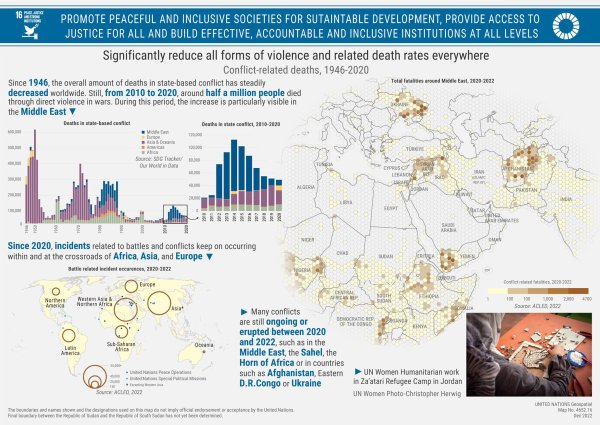
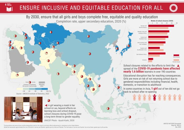
The United Nations Geospatial Team has created maps on each of the 17 Goals, showcasing the use of reliable data for understanding global and regional trends.
They have published several maps each week on the UN Geospatial website, including the below on SDG 4: Quality Education and SDG 16: Peace, Justice and Strong Institutions.
  |
The project is a collaboration of geospatial professionals in the Office of Information and Communications Technology in New York, the Global Service Centre in Brindisi, and field missions.
Challenges include:
- limitations in data availability, spatial, and time coverage
- format, data availability, and constraints of mapping software
- the complexity of data analysis
Mapping the SDGs is a continuation of the work started by the UN and the International Cartographic Association with the joint publication of Mapping for a Sustainable World in 2020.
